Category:SAGA GIS
English: SAGA GIS (System for Automated Geoscientific Analyses) is a free and open source geographic information system used for editing spatial data. It was originally developed by a small team at the Department of Physical Geography, University of Göttingen, Germany, and is now being maintained and extended by an international developer community.
map software  | |||||
| メディアをアップロード | |||||
| 分類 | |||||
|---|---|---|---|---|---|
| 作者 |
| ||||
| 利用許諾 | |||||
| 用途 | |||||
| 開発元 |
| ||||
| オペレーティングシステム |
| ||||
| バージョン |
| ||||
| 成立日 |
| ||||
| 公式ウェブサイト | |||||
| |||||
カテゴリ「SAGA GIS」にあるメディア
このカテゴリに属する 11 個のファイルのうち、 11 個を表示しています。
-
 Atlantismeteorcomplex3d.png 1,020 × 609;367キロバイト
-
 Azorestriple3d.png 1,020 × 609;369キロバイト
-
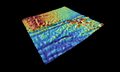
 Bouvettriplejunction3d.png 1,020 × 609;470キロバイト
-
 Charliegibbstransform.png 1,020 × 609;303キロバイト
-
 Cornerrise3d.png 1,018 × 607;274キロバイト
-
 GvSIG raster 01.png 800 × 555;212キロバイト
-
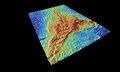
 Naturaliste3d.png 1,020 × 609;339キロバイト
-
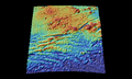
 Rodrigues3d.png 1,020 × 609;423キロバイト
-
 SAGA screenshot.jpg 614 × 480;110キロバイト
-
 Saga-gis.png 1,283 × 1,022;239キロバイト
-
 Trieste3d.png 1,022 × 583;184キロバイト


