
World Executive Political Enlarged Map - Laminated
$63.99
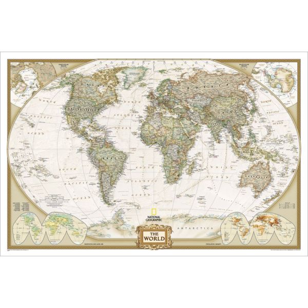
- Political National Geographic Cartography.
- Executive Earth-Toned Color Scheme; Ocean-Floor Relief.
- Deluxe, Double-Sided Lamination.
- Enlarged Dimensions: 49" x 73". Scale: 1:22,445,000.
Availability:
In stock
SKU
DG-NG-World-EEL
National Geographic's World Executive Political Enlarged Map - Laminated presents the planet's cartography in beautiful earth-toned shades. The political divisions of the landmasses are outlined in bold colors, and the underwater fractures, ridges and seamounts appear on over the ocean with detailed shading. The North and South Polar Regions are shown in separate insets in the corners of the executive map; along with two other insets that depict world densities and land/vegetation use. The World Executive Political Enlarged Map - Laminated is a handsome decorative addition to the home, school or office. The lamination allows this map to last for years to come.
National Geographic Maps
National Geographic is one of the most respected world authorities on cartography. For 100 years, the society has been producing state-of-the-art political, physical and thematic maps. The organization's cartographers utilize contemporary digital mapping techniques to inform the geography of these highly detailed maps. Since 1998, National Geographic has officially adopted the Winkel Tripel Map Projection to try to mediate spatial distortion on their products. The well-respected society aims to create products that "inspire people to care about and explore the world" by exhaustively researching the planet and holding all of their maps to exacting standards for cartographic excellence. National Geographic's commitment to creating accurate maps has secured and upheld their stellar reputation over their long history.
Write Your Own Review